Siem Reap in one day: the whole of it at Angkor, from first light to sunset at Pre Rup

Last updated 4 August 2026
Overview
A day in Siem Reap is not a day in Siem Reap. The town is flat, low and easy and you will see almost none of it, because everything you crossed the world for begins six kilometers north of it, spread across a park that holds both the largest religious monument in the world and a walled city of nine square kilometers, which once held somewhere between eighty and a hundred and fifty thousand people. So this page is a route rather than a list. The list is available anywhere and it is useless here: the temples are scattered over an area you could not walk across, and the difference between a good day and a wasted one is which thirty kilometers of road you spend it on.
What one day costs you is the far half of the park and the whole of the town. The carved pink sandstone of Banteay Srei, twenty-five kilometers beyond the main group; the collapsing corridors of Preah Khan; the long outer loop known as the Grand Circuit — each of those is a morning with a drive at both ends. The lake, the floating villages and the market lanes are the same decision. Give them up cleanly, because a day that tries to hold Angkor and Siem Reap holds neither and spends the difference in traffic. What follows is most of the short loop known as the Small Circuit, with its last stop borrowed from the long one, taken in the order that puts the sun where you want it.
The day rests on the two hours printed on the pass, and the one that shapes it is at the beginning. In 2026 the pass admitted nobody to the park before five in the morning and expired at half past six in the evening. Build the morning forward from the opening, and if the hour has moved, build it forward from the new one. Five is before sunrise in every month of the year at this latitude, by more than half an hour even at midsummer, and that is the whole point: Angkor Wat faces west, unlike almost every other temple here, so at dawn you stand in front of it with the sun coming up behind its towers. That is the one thing on this day that will not wait, and it is why the day starts in the dark rather than ending in it.
Count forward from five. Angkor Wat is worth three hours, Angkor Thom about two and a half, Ta Prohm an hour and the temple after it three quarters — roughly eight hours of temples and driving, which puts you back on the road in the early afternoon with the last stop still ahead. The gap between the two is the middle of the day out of the sun, and it is three hours or more. That is not slack in the plan, it is the plan: from March to May the middle of the day here is genuinely draining, and this is the part you shorten if you are running late rather than the part you cut. Two things the eight hours does not model: the heat, and the pass, which the count assumes is already in your hand rather than something you wait in line for in the dark. The last stop wants the hour before dark, and the sun goes down here between about half past five in the middle of November and about half past six at the end of June — a band of barely an hour across the whole year, so take your month’s hour and the arithmetic lands.
One structural thing, because it changes the day rather than decorating it. There is no left-luggage office anywhere on this route: no railway reaches Siem Reap at all, so there is not even a station to hold a bag, and the temples have nowhere to put one. What there is instead is the vehicle. This day is done in a tuk-tuk hired for the whole of it, and the driver waits at the exit of each temple while you walk through, which is where a bag has to go — agree that with him when you agree the route. It also means the two stops with a climb, the top level of Angkor Wat and the tiers of Pre Rup, are the two you do not do carrying anything. And it is worth saying plainly what the five o’clock start rules out: this day is taken from a bed in Siem Reap or straight off a night bus. A reader who lands at midday, bag and all, cannot have a shortened version of it — the dawn is the part that will not move — but there is a real day left, and it goes in this order: the covered outer gallery of Angkor Wat, which is the best hour here and is out of the sun; Ta Prohm, an hour, in forest; Banteay Kdei, three quarters of an hour on from it; Srah Srang across the road for something to eat; and Pre Rup for the last light, where this itinerary ends anyway. Hire the tuk-tuk for that half the same way and for the same reason — it is still the only place the bag can sit.
The day

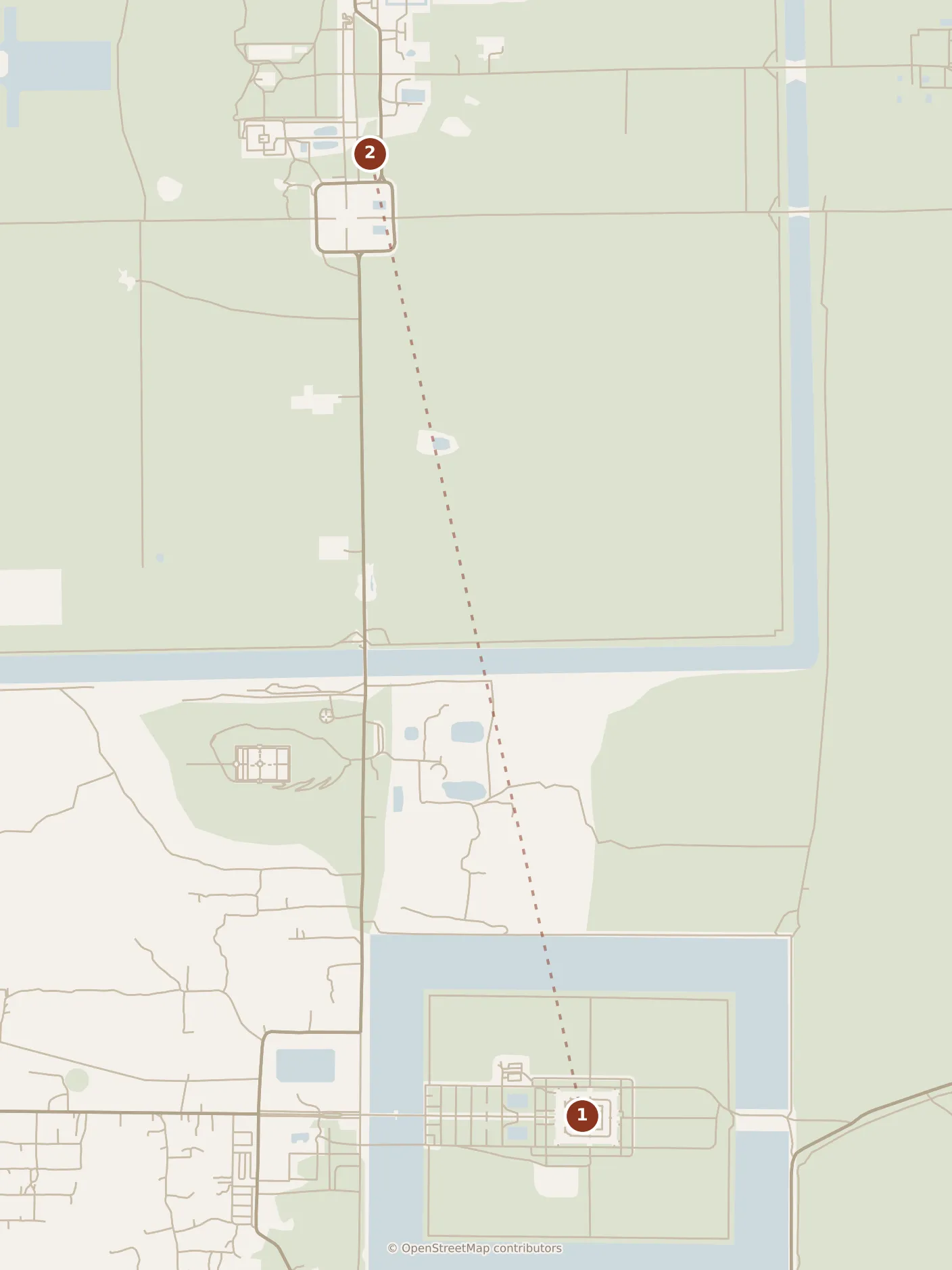
The ride on to stop 2, by taxi, not on foot.
- Morning
- 1Angkor Wat
- Morning
- 2Angkor Thom
- 3Bayon
- 4Baphuon
- 5Terrace of the Elephants
- Afternoon
- 6Ta Prohm
- 7Banteay Kdei
- 8Srah Srang
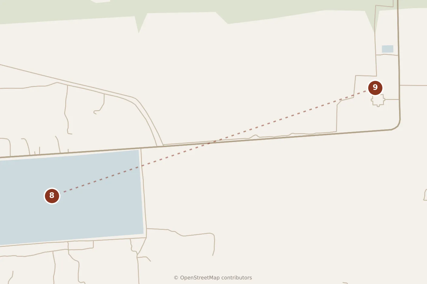
The leg out of the center: from stop 8 by taxi, not on foot.
- Evening
- 9Pre Rup
- Old Market — in the prose, not on the map
Morning
Be at the gate at five. The tuk-tuk stops at the western end of the causeway and the walk in to the central towers of Angkor Wat is the better part of a kilometer, done in the dark, past two ponds that flank the approach once you are through the outer gate.
The temple was built between 1113 and 1150 for Suryavarman II, as a Hindu temple to Vishnu and probably as his own tomb, and what makes the dawn work is that oddity of the plan: it is oriented west, so first light comes up behind the five towers and puts them in silhouette above their own reflection. That is twenty minutes and everyone on the site is doing it.
Then go in, while the crowd is still outside taking the photograph. The outer gallery is a continuous covered circuit of carved wall, 187 meters by 215, and it is the best hour on this itinerary. Walk it in one direction and it hands you everything: a procession of Suryavarman II under his parasols, thirty-two hells and thirty-seven heavens stacked in registers, and — on the side furthest from the entrance you came in by — the Churning of the Sea of Milk, ninety-two demons and eighty-eight gods hauling on the serpent Vasuki to turn an ocean into the elixir of immortality, with Vishnu presiding at the center. Above it, three galleries rise in stages to the quincunx of towers, and the innermost of them, the Bakan, is reached by stairways built deliberately too steep to be comfortable: the difficulty of climbing to the kingdom of the gods was the design. Give the whole thing three hours and go. The temptation to stay is real and what it costs you is Bayon.
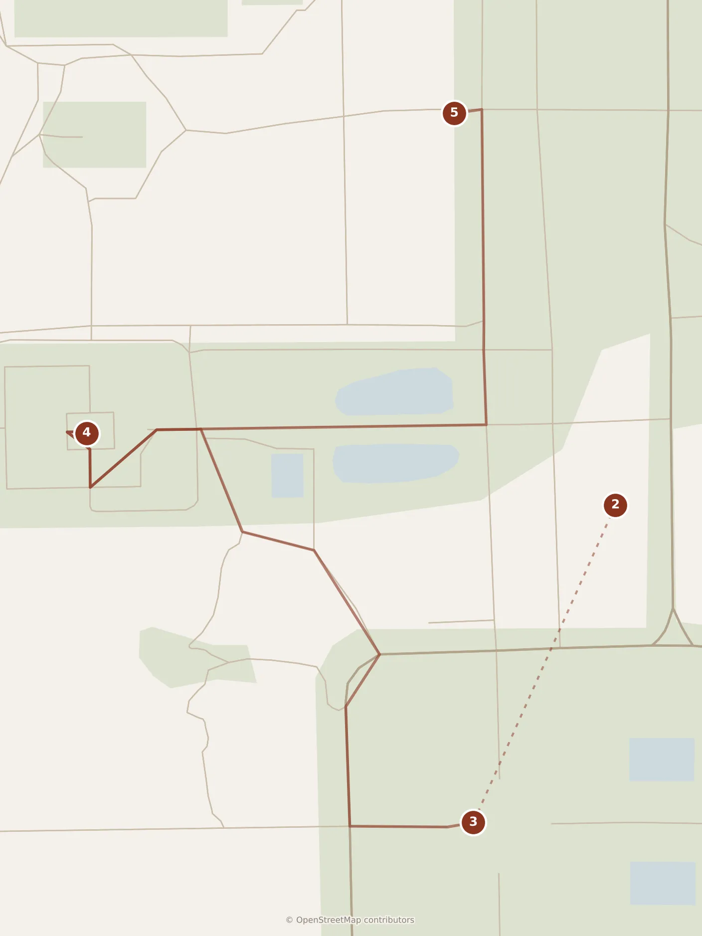
Five minutes north by road, the causeway into Angkor Thom crosses the moat between two long rows of stone figures, gods along one parapet and demons along the other, each row heaving on the body of a serpent; the gate tower above them carries four vast faces, one down each road. Twenty minutes here, then ride on into the middle of the walled city.
Bayon is Jayavarman VII’s state temple and the last one built at Angkor. From the ground it reads as rubble; the towers only resolve as you climb up among them, and then there are faces on all four sides of every one, more than two hundred by the usual count, all wearing the same closed-eyed half-smile. Who they are is unsettled — the king, the bodhisattva of compassion, or the two deliberately confused. An hour and a quarter. Do not skip the ground floor on the way out: the outer gallery here is carved not with gods but with ordinary life, a market, a cockfight, men eating, a woman giving birth, and it is the best surviving picture anyone has of how the Khmer Empire actually lived.
Eight minutes north-west on foot, Baphuon is a three-tiered temple mountain of the mid-eleventh century that was taken apart in the 1960s so its core could be rebuilt — three hundred thousand numbered blocks laid out across ten hectares of ground around it. Then the war came and the plans saying which block went where were lost. The second attempt started in 1996, took sixteen years, and the temple reopened in 2011. Walk round to the far side and climb: the back wall of the second tier is a reclining Buddha seventy meters long, assembled in the fifteenth century out of the temple’s own stones, and it is far more legible from twenty paces than from arm’s length. Half an hour.
Seven minutes on, the Terrace of the Elephants is where the morning ends: three hundred and fifty meters of retaining wall along the old central square, a parade of elephants and their handlers carved at each end and life-sized lions and garudas between them. Jayavarman VII stood on top of this to watch his army come home. Twenty minutes, walking its length.
Afternoon
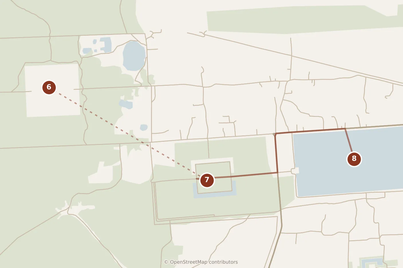
Leave the walled city by the Victory Gate on its eastern side; ten minutes of road puts you at Ta Prohm. This is the one temple you visit in the middle of the day on purpose, because it is the only one on this route standing in forest, and the shade is not a figure of speech.
It was founded in 1186 by Jayavarman VII as a monastery honouring his mother and it was called Rajavihara. Its own foundation stele records twelve and a half thousand people living in it, six hundred and fifteen of them dancers, with eighty thousand more in the villages around keeping it supplied. It was built without mortar, so when it was abandoned the trees rooted in the loosened joints — which is why the French, clearing Angkor in the last century, chose to leave this one as they found it, a concession, one of them wrote, to the general taste for the picturesque. That decision is why you are here, why the 2001 Tomb Raider was filmed here, and why it is busy at every hour of the day. An hour, and spend it walking the outer galleries rather than waiting in line at the two or three tree-roots everybody photographs.
Five minutes further east, Banteay Kdei is the same king, the same style and much the same plan as Ta Prohm, smaller, and, being none of the famous ones, often much quieter. It was built with poor sandstone and has been coming down for centuries, which gives it something the restored temples do not have: you walk galleries with daylight coming in where the roof went. Monks used it on and off until the 1960s. Forty-five minutes.
Local tip. Two ponds flank the causeway at Angkor Wat and almost everyone stands at the same one; the other holds the same five towers and, when it has water in it, the same reflection with a fraction of the heads in front of it. That choice runs through the whole day. The famous version of a thing here usually has a quieter twin a few hundred meters away, and Banteay Kdei is Ta Prohm’s.
Out of Banteay Kdei’s eastern gate the road is immediately there, and directly across it is the water of Srah Srang: a reservoir seven hundred meters by three hundred and fifty, dug in the tenth century as a royal bath and given its cruciform stone landing-stage, serpent balustrades and two guardian lions around the year 1200. This is the middle of the day, and it is a stop rather than a sight. The stalls that sit at the entrance of every large temple here are where lunch is, and fish amok — the coconut curry steamed until it sets — is the thing to order. Then sit down and stay sat. The landing-stage looks east across the water, which makes this a sunrise place and not a sunset one.
Evening
Pre Rup is five minutes east and it is the last thing. It is the oldest temple on this day — a state temple dedicated in 961 or early 962, a century before the Baphuon and a century and a half before Angkor Wat — and it is built of brick and laterite rather than sandstone, which is the entire reason it is here at the end rather than the beginning: the material is reddish, and low sun does something to it that midday flattens. Three steep tiers climb about twelve meters to a platform carrying five towers in a quincunx, and the climb is the visit. Its modern name means turn the body, from an old belief that cremations were held here; the stone trough near the eastern entrance gets pointed out as the evidence, though scholars think it was the base for a bronze bull.
Be up on the top tier while the light is still on the brick rather than arriving as it goes, and start down before it has gone: the tiers are steep, the treads are shallow and nothing here is lit. Then it is half an hour back into town, and the day ends where the town’s does, in the lanes around the Old Market, where lok lak is the right end to a day spent almost entirely upright.
The one meal this itinerary cannot give you is breakfast. Num banh chok, the fermented-rice-noodle bowl the town eats in the morning, is sold from stalls that are trading while you are standing in the dark at Angkor Wat. That is the trade and it is worth making. And if you are flying out rather than staying, note the shape: Siem Reap-Angkor International Airport is a long way east of both the park and the town, the drive out to it is the one the city guide describes, and there is no version of it that is quick — so a sunset at Pre Rup and an evening flight do not both fit. Pick one before you plan the afternoon, not after it.
Practicalities
One thing has to be bought before you set out and it is the only cost on this route besides the driver and the food: the Angkor Pass. It is not sold at any of the temples on this route. The official issuer sells it online, and the one-day version was in the thirty-five to forty US dollar range in 2026; the alternative is the ticket center out on the road toward the park, which for a five o’clock start means waiting in line in the dark before the day has begun. Buy it the night before. The one-day version is the one that needs no photograph — the three- and seven-day passes do — and it arrives by email rather than being collected anywhere; bought late in the afternoon of the day before, it also admits you to the park that same evening, which is a sunset the plan did not count on. Everything else about the pass — how it is checked, why the three-day version is usually the better buy — belongs to the city guide, and if you have three days you should be reading that page instead of this one.
The two hours this day rests on are both the pass’s, and in 2026 they were five in the morning and half past six in the evening. The first is what makes the dawn possible and the whole morning is counted forward from it; if it moves, count forward from the new one. The second is invisible until you are standing at Pre Rup with the light going: between early June and early August the sun here sets after half past six, which is after the pass has expired. In those two months this is not a sunset stop at all — take Pre Rup for the late light, be out of the park on time, and give the extra hour to Banteay Kdei instead.
Nothing on this route closes one day a week. They are archaeological sites rather than museums, and that is the real advantage of a day at Angkor over a day in most cities: it survives a Monday intact. What can be closed is a part rather than a whole — the top level of Angkor Wat is the one piece of this day that may be shut when you reach it, and one rule on it is published rather than variable: the official issuer restricts the climb to the upper tower to visitors aged twelve and above, so a child under that age is turned back at the checkpoint. Check both with the issuer before you commit the morning to that climb, and if it is shut the carved outer gallery below is the better hour anyway. The other name you will see attached to this day is Phnom Bakheng, the hilltop temple sold everywhere as the sunset spot; the weight of people on it has made it one of the most threatened monuments in the park, and Pre Rup is the same hour with better stone and a fraction of the crowd.
The season changes two stops rather than the whole route. From March to May the long midday stop at Srah Srang stops being a rest and becomes the reason the day is survivable, so do not trade it for a sixth temple. From June to October the afternoon brings one heavy, short downpour: Ta Prohm is the stop that is genuinely better in it, being under trees, and the moats and the reservoir fill, which makes Srah Srang with water in it a different place from Srah Srang without.
All of the above moves by hired tuk-tuk, and the route should be agreed the night before — including the five o’clock start and the last stop, because a driver expecting a standard morning run will have made other plans for his afternoon. What you actually walk is inside the temples rather than between them. The longest continuous stretch on your feet is Angkor Wat itself, from the road in to the central towers and back again; after that nothing exceeds a quarter of an hour — eight minutes from Bayon to Baphuon, seven more to the Terrace of the Elephants, and the crossing from Banteay Kdei’s eastern gate to the water at Srah Srang.


